

Four Thousand Mile Long River of Moisture Could Dump 2 Feet of Rain on The Pacific Northwest
11
October, 2016
As
the U.S. East Coast is still reeling from impacts associated with
Hurricane Matthew,
the Pacific Northwest is just now confronting its own potential
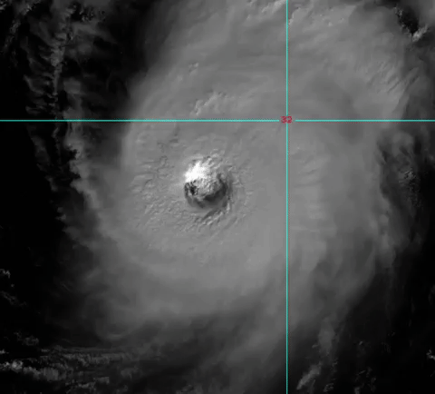
extreme climate event. For a 4,000 mile long river of moisture
streaming off ex super typhoon Songda in the Pacific Ocean is now
firing a barrage of storms at Northern California, Oregon,
Washington, and British Columbia. A series of storms that could, over
the next five days, dump as much as two feet of rainfall over parts
of this region.
Powerful
Atmospheric River May Produce 2 Feet or More of Rainfall This Week
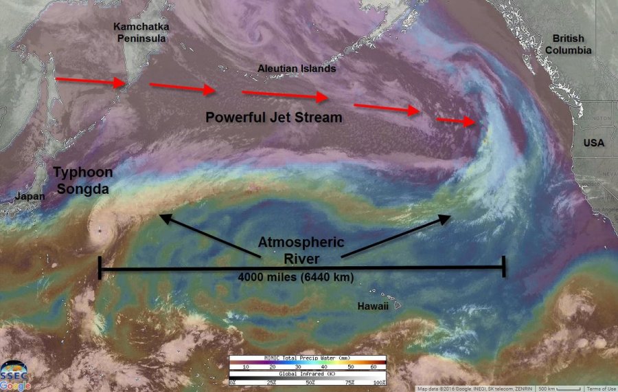
(A
powerful atmospheric river is forming over the record hot Pacific
Ocean in a record hot atmosphere. Typhoon Songda is delivering a
great deal of tropical moisture to this flow — which is expected to
impact the Pacific Northwest and produce very heavy rainfall this
week. Image source: Weatherbug.)
Jet
stream winds running across the Pacific now range between 180 and 220
mph. These strong winds are producing a powerful storm track even as
they are tapping a vast plume of tropical moisture over the Eastern
Pacific. Embedded
in this moisture plume is the rain-rich ex supertyphoon Songda.
As the strong upper level winds pull in Songda and draw on the
extreme moisture bleed rising up off the record-hot waters of the
Pacific Ocean, forecasters expect a resulting atmospheric river to
run 4,000 miles across the Pacific Ocean and deliver storm after
powerful storm to the Pacific Northwest.
NOAA
model forecasts now show as much as 22 inches of rain falling upon
parts of this region over the coming 7 days. However, with so much
moisture loading up the atmosphere, it’s possible that locally
higher amounts of rainfall will occur.
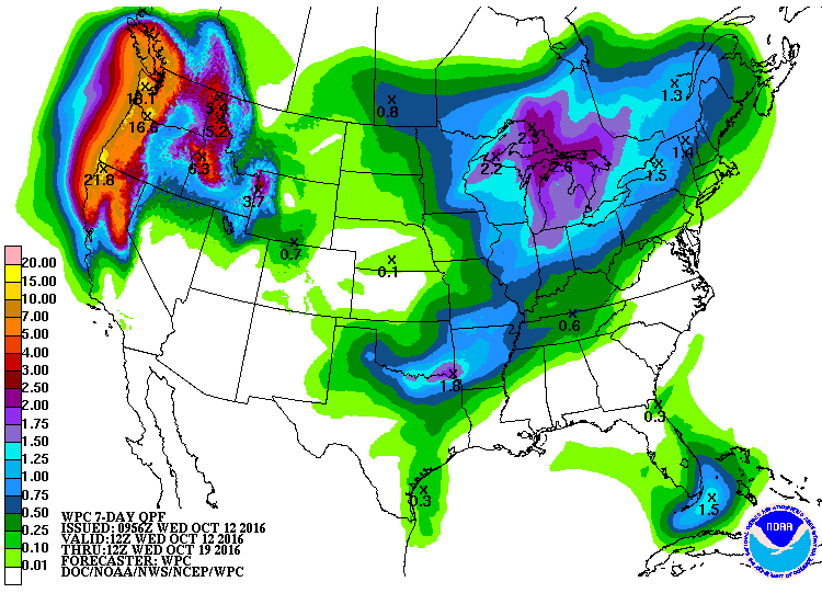
(Very
heavy rains in the range of 7-22 inches or more are expected to fall
over the Pacific Northwest this week in associate with a powerful
river of moisture streaming off the record-hot Pacific Ocean. Image
source: NOAA.)
Conditions
in the Context of Climate Change — Here We Go Again
Over
the past year, a record hot atmosphere has helped to generate extreme
moisture levels aloft. Such record to near record moisture levels
have helped to produce 500 to 1,000 year flood events in places like
Louisiana, Texas, North Carolina, Maryland, Virginia and in other
parts of the US and around the world. This week, record high moisture
levels contributed to flooding rains falling over Virginia and North
Carolina in association with Hurricane Matthew. Now, a similar
extreme moisture pattern is taking aim at the Pacific Northwest.
So
this is kind of a ‘here we go again’ situation. And,
unfortunately, these types of extreme weather events are now more
likely due to the fact that a world now in the range of 1-1.2 degrees
Celsius warmer than 1880s averages is one in which a higher volume of
water evaporates from the land and ocean surfaces and into the Earths
atmosphere. Such a physical dynamic related to human-forced warming
is one that increases rainfall even as it provides more fuel for
powerful storms.
Links:
Hat
tip to Colorado Bob
Hat
tip to DT Lange
Hat
tip to Greg
No comments:
Post a Comment
Note: only a member of this blog may post a comment.