

Harvey Intensifies Slightly Just Prior to Second Landfall
29 August, 2017
Tropical
Storm Harvey, which
has dumped more than 51 inches of rain over parts of Texas and
flooded hundreds of thousands of homes, intensified this afternoon
over the Gulf of Mexico as it continued to move to the
North-Northeast.
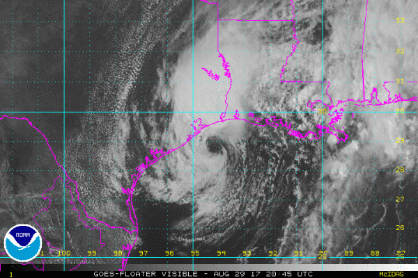
(Visible satellite imagery of Tropical Storm Harvey late afternoon on August 29th shows the storm slightly re-intensifying before a second landfall with strong rain bands again threatening Houston. Image source: The National Hurricane Center.)
As
of the 4 PM CDT advisory from the National Hurricane Center,
Harvey’s minimum central pressure had dropped to 994 mb even as its
maximum sustained winds increased to 50 mph. This made Harvey a still
rather weak tropical storm is it continued to lash sections of
Eastern Texas and Louisiana with winds and rains.
Now
a 5-day long event since threatening the Texas Coast as a category 4
storm on Thursday,Harvey
has produced the worst flooding in Texas state history.
In Houston, dams designed to contain a 1,000 year flood are
overflowing — increasing already catastrophic flooding throughout
the beleaguered city.
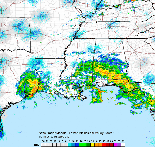
(After a brief respite, Houston’s eastern suburbs are again seeing heavy rain from Harvey. Image source: National Weather Service.)
Very
heavy rains have fallen over Houston since Saturday. But during the
early afternoon hours rains had lightened over the city as the
heaviest squalls shifted further east over Beaumont. Recent weather
radar imagery from the National
Weather Service,
however, has shown more intense rain bands again back-filling over
Eastern Houston in coordination with Harvey’s recent
re-intensification.
Tonight,
Harvey is expected to track inland before being pulled northward by a
trough and finally leaving Southeastern Texas behind. But not before
giving the region one last lashing over the next 12-24 hours or so
while dumping another 6-12 inches of rain.
RELATED
STATEMENTS AND INFORMATION:

Amazing video sent to us @KHOU, freeway concrete barrier broke away on Hwy 59 at San Jacinto Bridge. #HoustonFloods
Looks like all-time U.S. record for most rainfall from a tropical system is about to be broken as well. #Harvey #climatechange#Texasflood https://twitter.com/ABC/status/902649806983766017 …
P.S. This is how things look right now.

No comments:
Post a Comment
Note: only a member of this blog may post a comment.